
Simulation · Minimal Water · Dams and reservoirs
Haltern am See – reservoir and waterworks
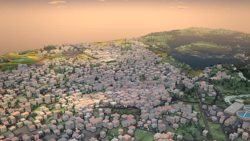
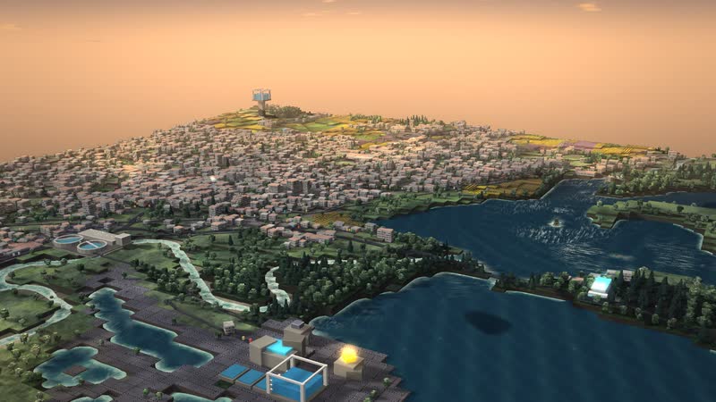
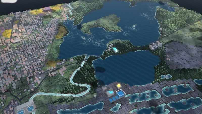
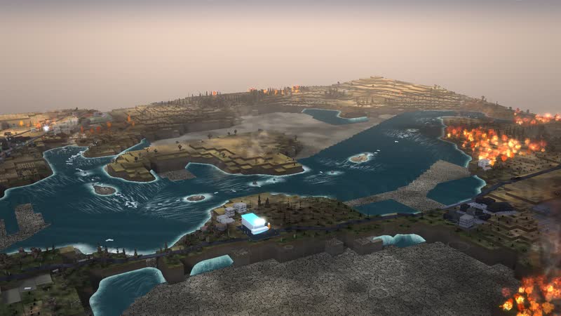
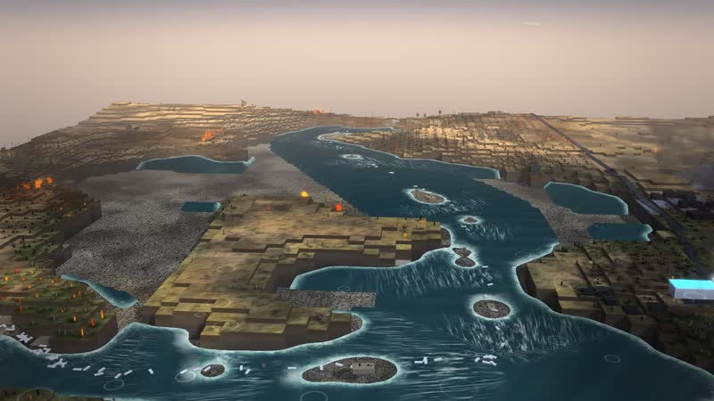
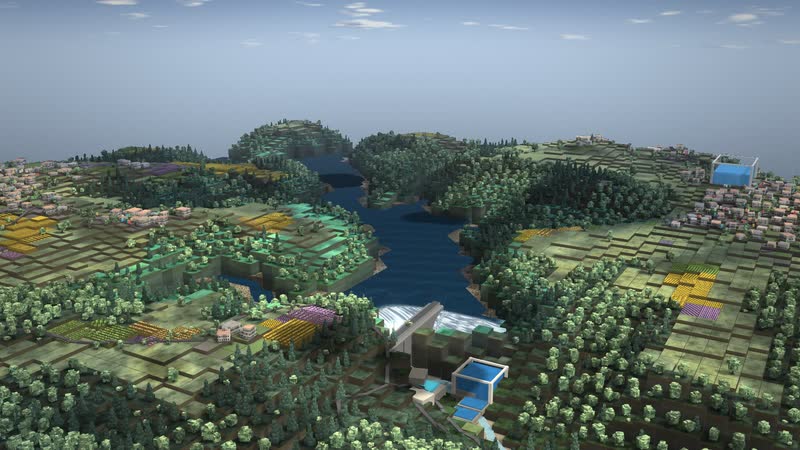
A reservoir in flat country as a model: water that seeps through sand and is filtered, a works at the lake with a deep tank, and a water tower on the slope that holds the pressure for the town.
Trailer
Real are location, terrain and buildings (OpenStreetMap, heights from SRTM and EU-DEM). The water tower, the pipe network, sizes and demand are invented and simplified, and treatment is a feed-in with limited capacity. It is not an operations control and not a planning tool. With your data, the model shows your site and your processes.
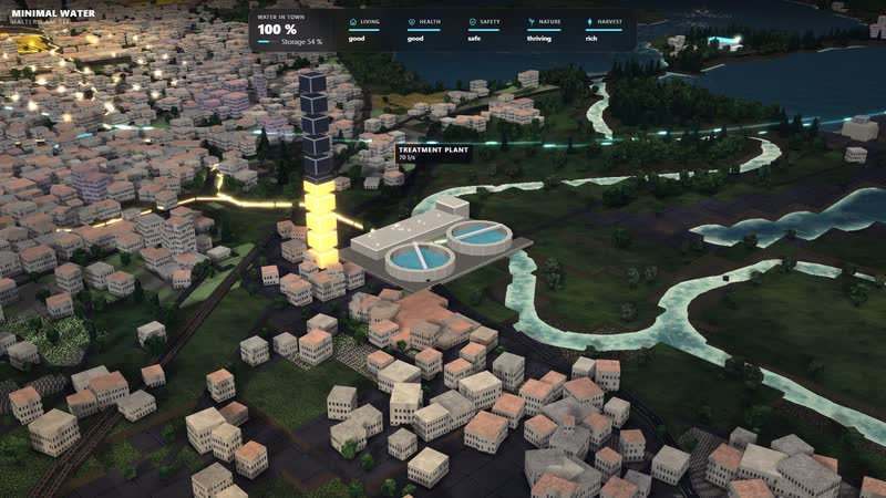
The Haltern reservoir stores water for one of the largest waterworks in Germany; it seeps through the sand of the Haard and the Hohe Mark and is filtered naturally on the way. In the model the works at the lake treats the water and collects it in the deep tank, and pumps push it through the main pipe to the town. In flat country the pressure comes from the height of a water tower on the slope, which holds the network pressure and buffers peaks; the wastewater runs through the sewer to the sewage works.
Three controls move the whole landscape: rain, heat and consumption, plus the weather situations normal year, hot summer, drought and heavy rain. In a drought the lake runs dry from the shore, fields and woods wither; in heavy rain it fills, and the town's sewers reach their limit. The estate on the slope, at about 63 m, lies close to the tower height and reacts sensitively to the level in the tower.
Real are location, terrain and buildings; the position of the waterworks is based on OpenStreetMap. The tower, the pipe network, sizes and demand are invented and simplified; quantities and processes are model assumptions. The page is for schools and universities, exhibitions, municipalities and water supply.
The path of water
- 01
the reservoir stores the water
- 02
it seeps through the sand and is filtered
- 03
the works on the lake treat it and collect it in the low-level tank
- 04
pumps push it through the main to the town
- 05
the hillside water tower holds the pressure
- 06
through the sewer to the treatment plant
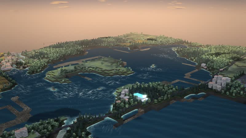
01
Water shapes the land
Haltern am See: Lake Haltern stores water for one of the largest waterworks in Germany; a hillside water tower holds the pressure in the flat country.
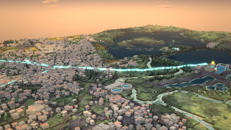
02
The path of water
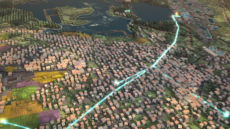
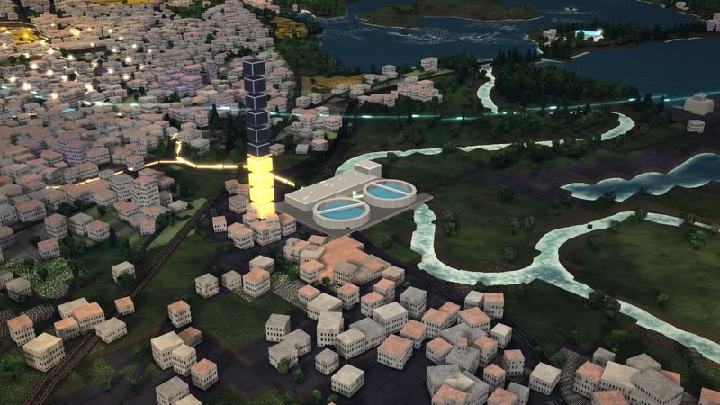
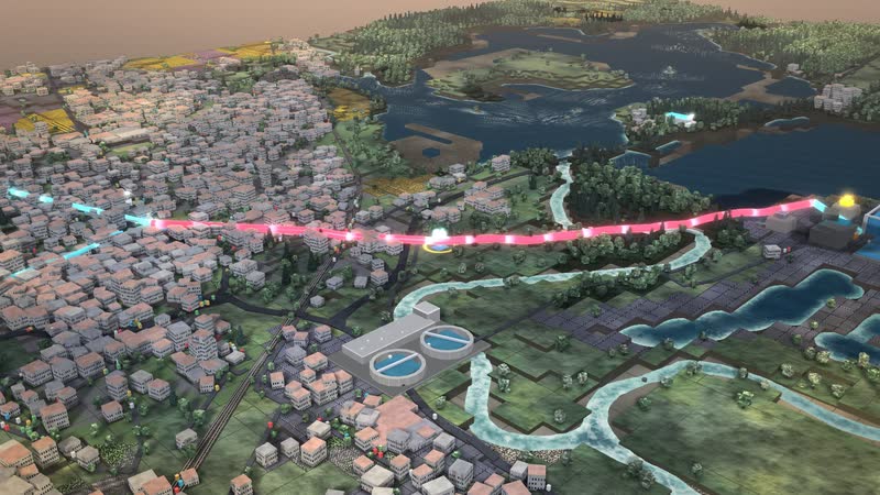
Glowing pipes – the path of the water as one continuous line, the waves run with the speed and direction of the flow.
What is shown – why – for whom
| What is shown | Why | For whom |
|---|---|---|
| Reservoir with falling water level | WhyShows how a lake holds water for dry times and drops when the rain stays away. | For whomteaching, exhibition |
| Waterworks at the reservoir with deep tank | WhyShows where the water is collected; treatment is a simplified feed-in. | For whomteaching, water supply |
| Pumps and main pipe to the town | WhyShows how the water is pushed into town without a fall. | For whomteaching, municipalities |
| Water tower on the slope | WhyShows how a high tank holds the network pressure and buffers peaks. | For whomteaching, water supply |
| Town centre, Gewerbe West commercial area and estate on the slope | WhyShows districts at about 47 m to 63 m; the estate on the slope is sensitive to the level in the tower. | For whommunicipalities, teaching |
| Sewer and sewage works | WhyShows where the wastewater goes and when the plant overflows in a storm. | For whommunicipalities, civil protection |
| Three controls and four weather situations | WhyShows connections in the model, not a statement about reality. | For whomteaching, education |
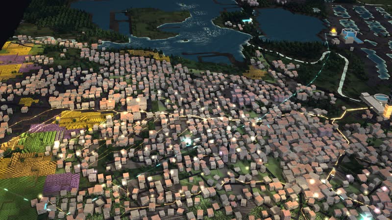
03
The city from within
Wastewater – From the house through the sewer to the plant.
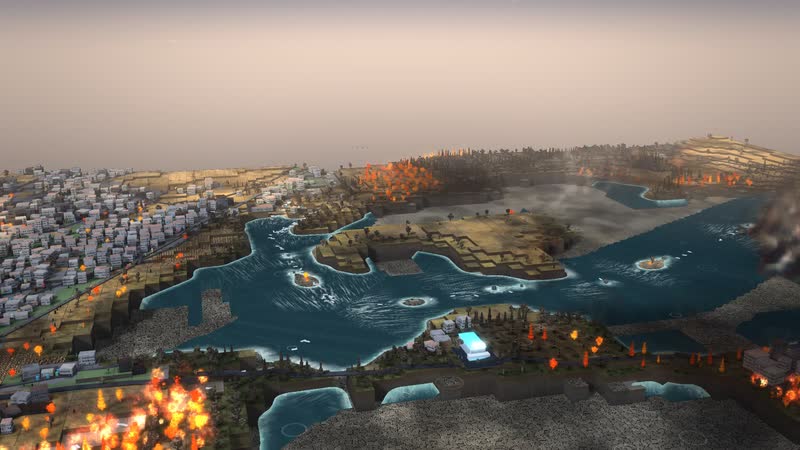
04
When things get tight
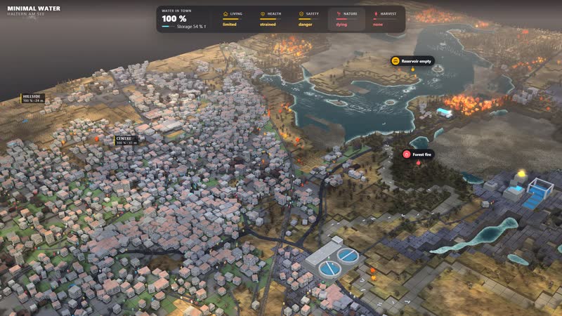
Forest fire – in drought and great heat a glowing front eats through the forest, rain puts it out.
Films from the model
-
Above Haltern am See
A flight across the area: low angles with sky, the reservoir in front of the town, the waterworks on its shore, then over the town to the long shot – with the sound of the landscape.
-
The path of water
From the source via the works and the storage into the town, through the sewer and back into the river: station by station, the pipes glowing.
-
The city opens up
Beneath the streets: first the pipes, then the open cross-section, wastewater, rainwater in heavy rain, greywater – and everything together.
-
A water year
A normal year, then heat and drought: fields wither, river and lake sink, the forest burns – then heavy rain, thunderstorm and flood. The landscape answers in real time.
-
Pipe burst and flood
First a main bursts: the spot pulses red, a crew drives out, the storage carries the town. Then heavy rain: the water rises by elevation into floodplain and districts.
-
Using the software
With the full interface: tap weather situations, pull levers, look at stations on the wheel and consequences – every effect shows at once on the map.
Facilities and landscape in the model
-
Lakeside waterworks
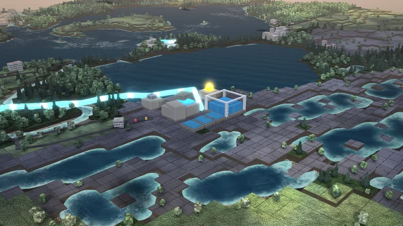
Treats water from the reservoir lake and collects it in the low tank. Treatment is not simulated – simplified supply with limited capacity.
-
Hillside water tower
In flat land pressure comes from the height of the tower: it holds network pressure and buffers peaks. (Schematic, invented.).
-
Lake
The lake holds water for dry times; in the model its level sinks when the rain stays away.
-
Town centre
Old town and residential areas, about 48 m.
-
West industry
Large consumer with shift work, about 47 m.
-
Hillside estate
Houses on the slope, about 63 m – close to tower height, sensitive to the tower level.
-
Treatment plant
The treatment plant cleans the waste water and returns it to the river. In a storm it overflows.
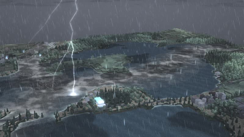
05
Thunderstorm
Thunderstorm – lightning in view, the cloud lights up from within around the strike, the cover tears open along the line of sight.
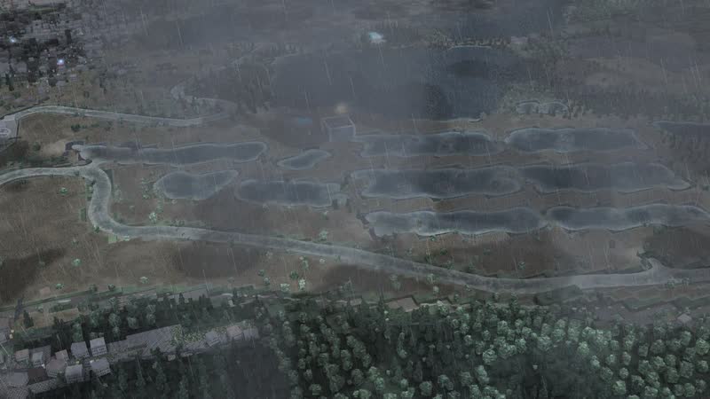
06
Flood by contour lines
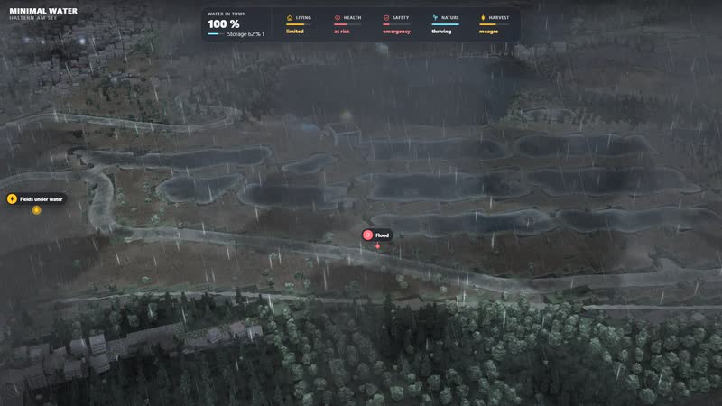
Flood by contour lines – the floodplain and low-lying districts fill up bit by bit, with a dirty rim of foam.
Processes in the model
The path of water
- 01the reservoir stores the water
- 02it seeps through the sand and is filtered
- 03the works on the lake treat it and collect it in the low-level tank
- 04pumps push it through the main to the town
- 05the hillside water tower holds the pressure
- 06through the sewer to the treatment plant
Heat and drought
- 01no rain and great heat
- 02the soil dries out, the river narrows
- 03the fields wither first
- 04the forest dies and burns, rain puts it out
- 05the lake sinks and dries out from the shore
- 06water runs short in the town, the storage empties
- 07rain brings soil, river and harvest back quickly; dead forest takes far longer
Heavy rain and flood
- 01the soil soaks up all it can
- 02what it cannot hold rushes into streams and the river
- 03the floodplain and low-lying districts fill by contour line
- 04sewers and treatment plant reach their limit
- 05after the rain the water falls again
Pipe burst
- 01a pipe bursts, water escapes
- 02a crew drives out from the depot
- 03the section is shut off
- 04the storage carries the town
- 05after the repair the pipe goes back into service
What the model can be used for
-
How sand filters water
The water seeps through the sand of the Haard and the Hohe Mark and is filtered naturally on the way. You see the path from the lake via the works into town.
For whomschools, universities, exhibitions
-
What a water tower is for in flat country
Where there is no fall, the pressure comes from the height of the tower. The model shows how it holds the network pressure, buffers peaks and which estate reacts first.
For whomwater supply, universities, training
-
Playing through drought and heavy rain
The lake drops from the shore, fields and woods wither; in heavy rain it fills and the sewers reach their limit. You see what gets tight first.
For whomcivil protection, municipalities, education
-
Museum and exhibition
A lake, a works and a town on a plain: the model shows how water gets its pressure without a mountain.
For whommuseums, exhibitions, visitor centres
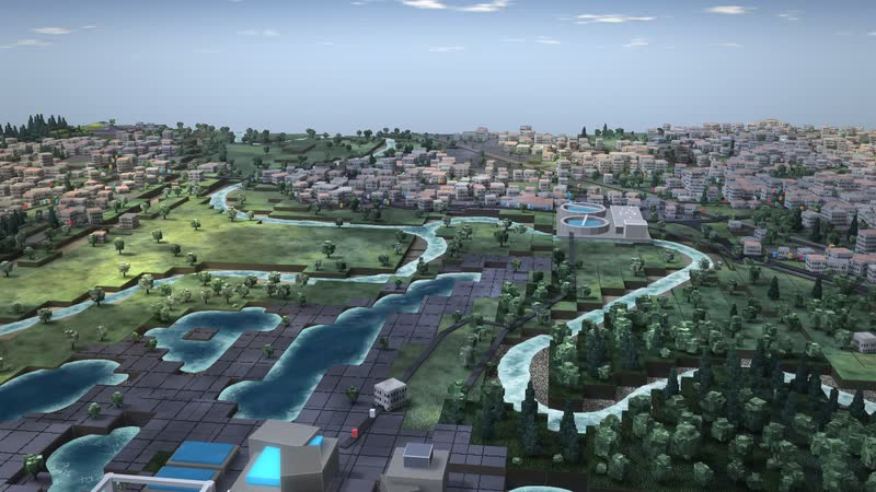
07
The course
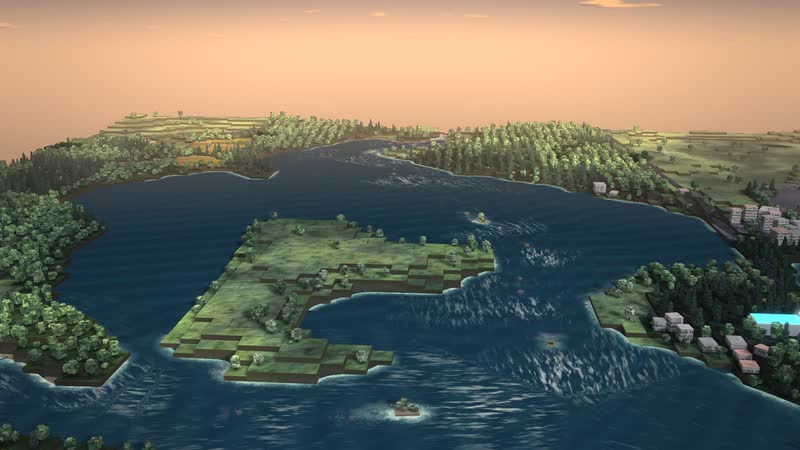
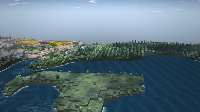
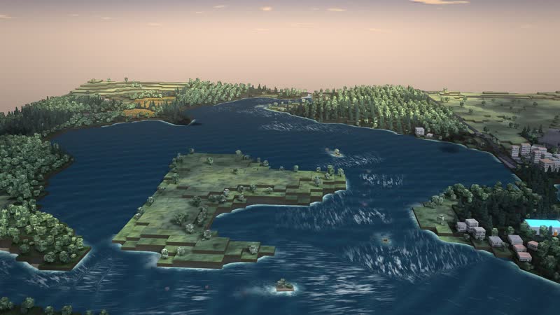
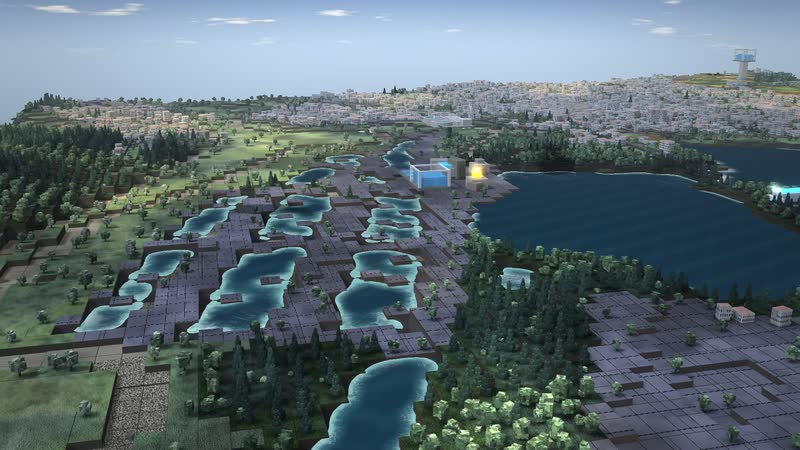
The course – the reservoir in front of the town, the waterworks on its shore; waves and foam move with the current in real time.
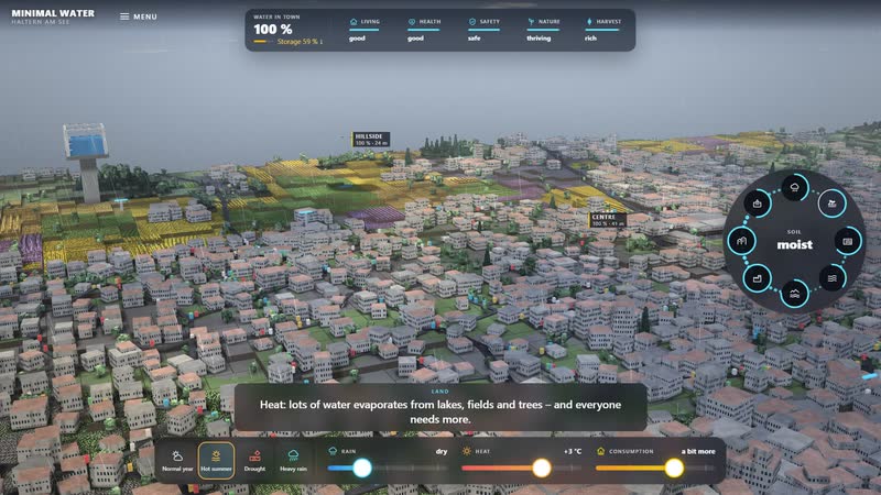
08
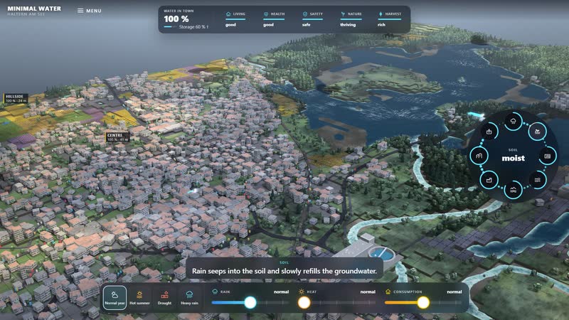
The whole software
Hot summer with one tap – the levers visibly move there, the camera follows the effect, below a sentence explains what is happening.
What you can change
Controls
- Rain: From drought to storm: rain fills soil, groundwater and river; little rain lets everything dry out, a lot of it lets it overflow.
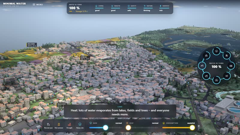
- Heat: Up to four degrees more: more evaporates from lakes, fields and trees, and everyone needs more water.
- Consumption: From frugal to wasteful: wasteful speeds up the shortage, frugal delays it.
- Weather situations: Normal year, Hot summer, Drought, Heavy rain: One tap sets all three levers, they visibly move there, and the view goes to where the effect shows.
Disruptions
- Water shortage: Water is running short in town: the first homes are without water – people are moving away.
- Failed harvest: The fields are withering – the harvest fails, food becomes scarce and expensive.
- Fish die-off: The river is shallow and warm, oxygen is running out – the fish are dying.
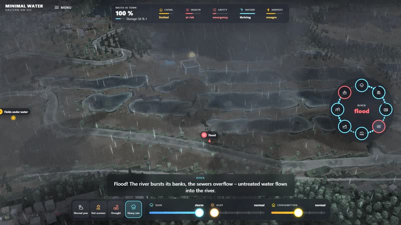
- Flood: Flood! The river bursts its banks, the sewers overflow – untreated water flows into the river.
- Health: Without enough clean water, health suffers: heat, poor hygiene, disease. Ambulances are on their way.
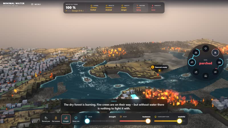
- Forest fire: The dry forest is burning. Fire crews are on their way – but without water there is nothing to fight it with.
- Tree dieback: The trees are dying. It takes decades for a forest to grow back.
- Lake almost empty: The reservoir is almost empty. It supported the river – now the water for dry times is missing.
- Pipe burst: Pipe bursts hit lines, never a single building; the storage carries the town until the crew has repaired the section.
- The extreme: Everything is parched: no water, no harvest, no trees, no animals. Life is no longer possible here.
What the model brings
-
01
The real landscape as a stage
Lake, woods and town stand on terrain from OpenStreetMap and elevation data. You show the place as it lies, not as a diagram.
-
02
From the lake to the tower, step by step
Seepage, works, deep tank, main pipe and water tower can be shown one by one. You understand the path before you change anything.
-
03
Situations without damage
Drought, heavy rain, pipe burst: you see where it gets tight first, and set it back. A pipe burst hits a pipe, never a single building.
-
04
In the browser, with one tap
The model runs in the browser. One tap sets rain, heat and consumption together to a weather situation.
-
Haltern am See: Lake Haltern stores water for one of the largest waterworks in Germany; a hillside water tower holds the pressure in the flat country. -
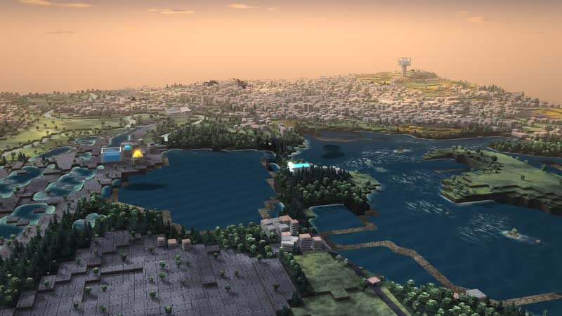
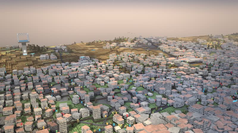
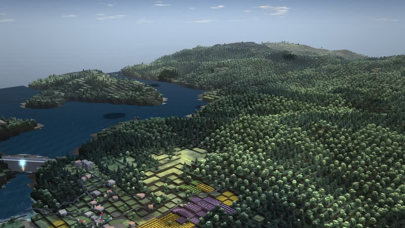
Haltern am See in the evening – low sun, long shadows, the water mirrors the sky. -
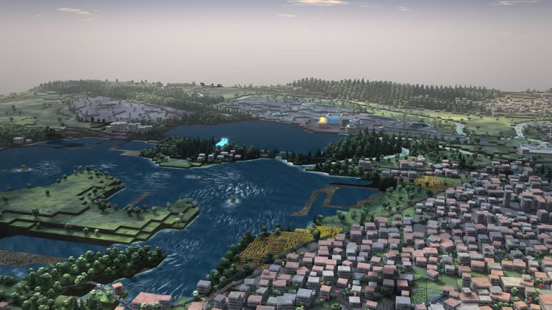
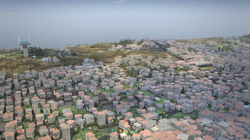
Morning at the reservoir in Haltern – haze over the land, terrain and buildings come from elevation data and OpenStreetMap. -
The course – the reservoir in front of the town, the waterworks on its shore; waves and foam move with the current in real time. -
Far across the land – forest, fields and settlements hang on the same water. -
The lake as storage – it holds water for dry times; in the model its level sinks when the rain stays away. -
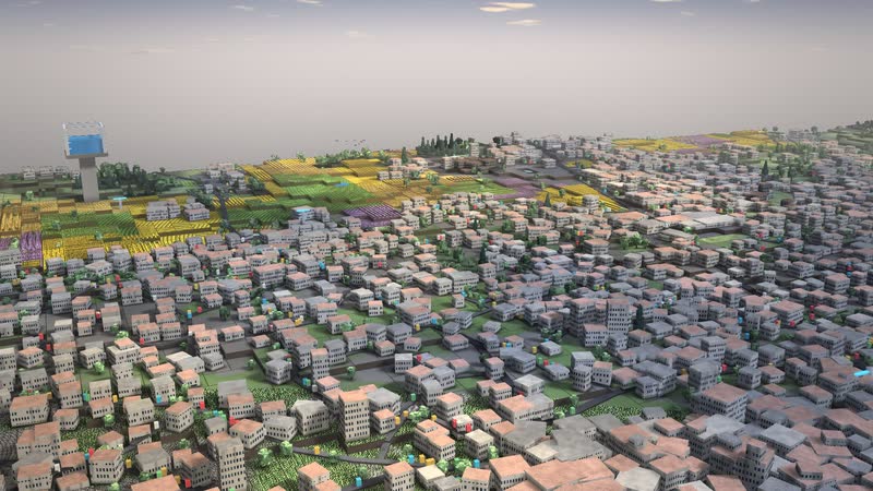
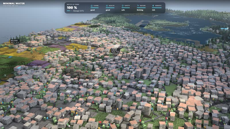
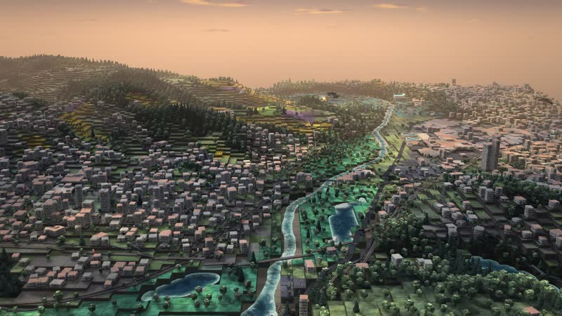
Town centre from outside – every house a block, warm in the evening light. -
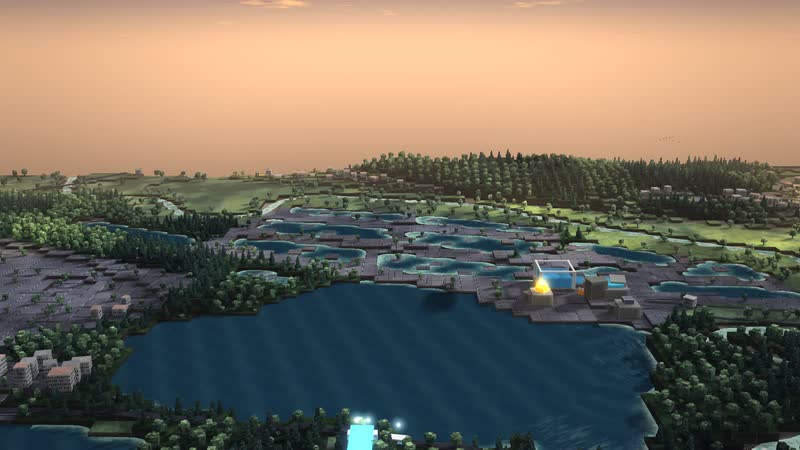
Dusk at the reservoir in Haltern – the houses grow darker, the last glow lies over the land. -
Forest – deciduous trees with trunk and crown, conifers in stands; here the cycle begins with the rain that stays in the soil. -
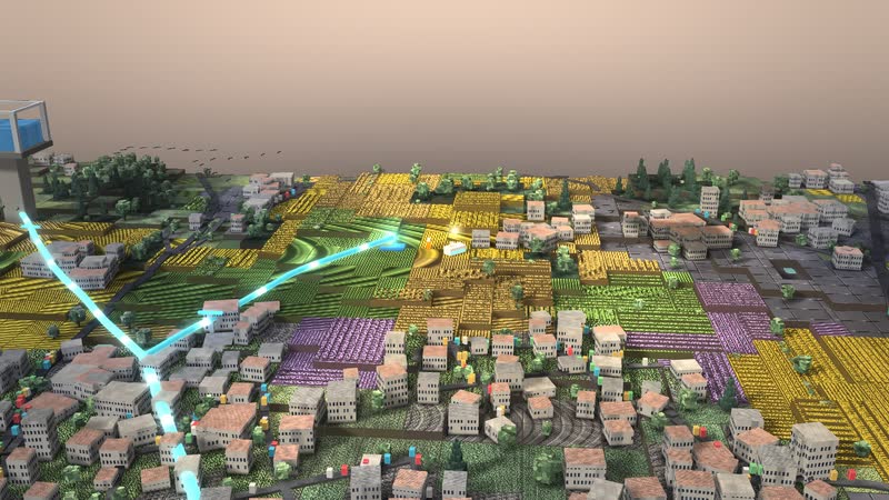
Fields and meadows – the rows grow with the harvest and wither in the drought; the soil is a sponge. -
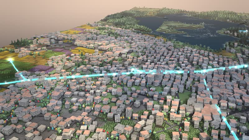
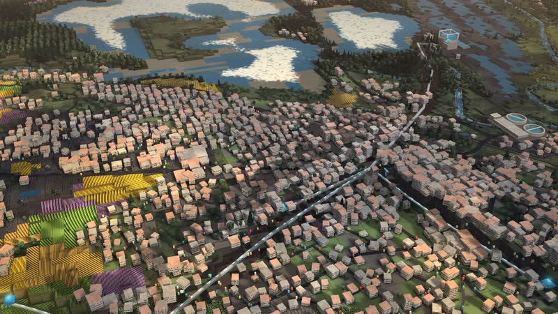
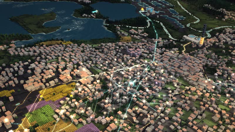
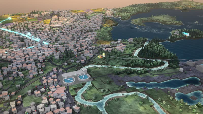
Haltern am See from above at an angle – the whole area as a model of blocks, with the network at its centre. -
The source – the water comes from the lake; it is the area’s storage. -
Lakeside waterworks – Treats water from the reservoir lake and collects it in the low tank. Treatment is not simulated – simplified supply with limited capacity. -
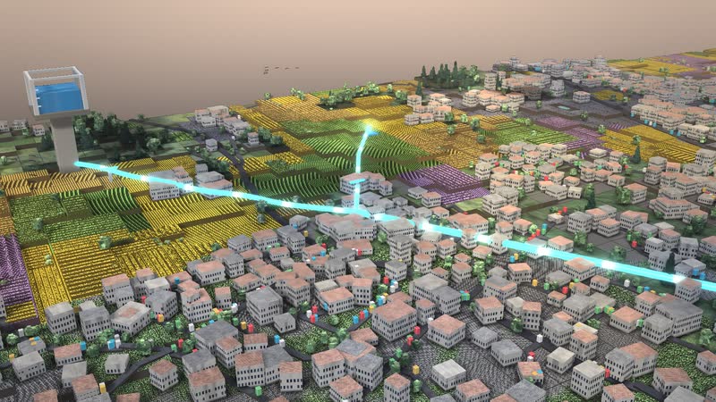
Hillside water tower – In flat land pressure comes from the height of the tower: it holds network pressure and buffers peaks. (Schematic, invented.) -
Glowing pipes – the path of the water as one continuous line, the waves run with the speed and direction of the flow. -
Town centre – Old town and residential areas, about 48 m. -
Hillside estate – Houses on the slope, about 63 m – close to tower height, sensitive to the tower level. -
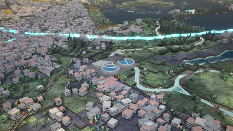
The treatment plant cleans the waste water and returns it to the river. In a storm it overflows. -
Back in the river – what has been cleaned flows back in; downstream the cycle starts again. -
The city from within – pipes and connections: width by flow, light runs from the reservoir to the houses. -
Cross-section – the ground opens up, pipes lie exposed beneath the streets. -
Wastewater – From the house through the sewer to the plant. -
Rainwater – sealed surfaces drain off: what does not soak away runs over streets and through sewers. -
All at a glance – drinking water and sewer together: what flows into the houses runs out again below. -
The sewer ends at the treatment plant – in a normal year it cleans everything, in a storm it overflows. -
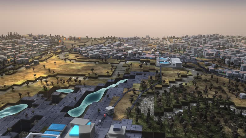
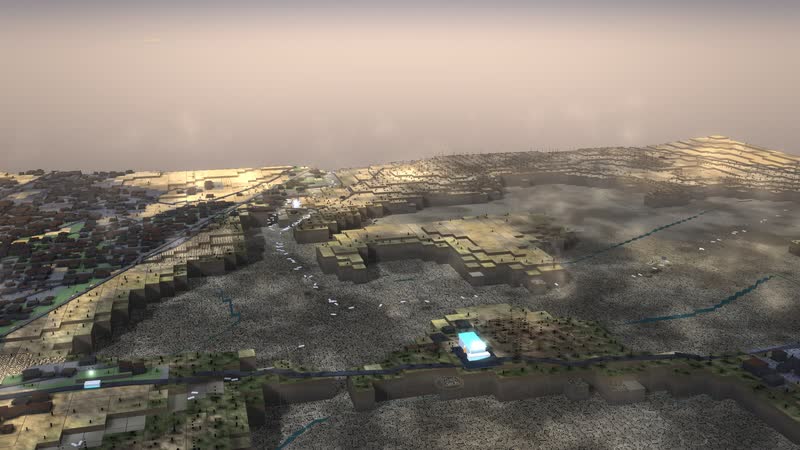
Hot summer – little rain, more evaporation: the soil dries out, people need more, the town’s storage sinks. -
Drought – the fields wither first: green turns to straw, the rows wilt, the harvest fails. -
Low water – the river carries very little, grows narrow and warm; oxygen runs short and the fish die. -
Forest fire – in drought and great heat a glowing front eats through the forest, rain puts it out. -
Smoke over the land – the fires carry dark columns, lit from within, visible from afar. -
The lake sinks – it has supported the river, the bed dries out from the shore; now the water for dry times is missing. -
What remains – fields and town recover quickly, dead and burnt forest stays visible for a long time. -
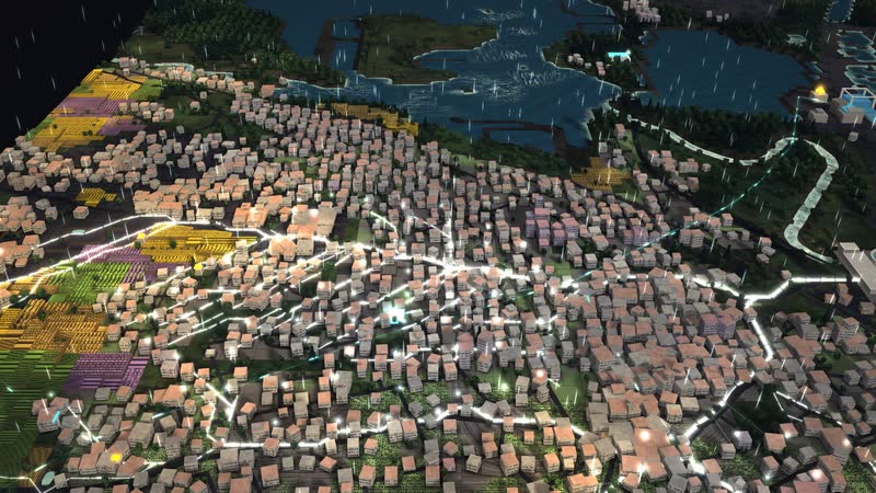
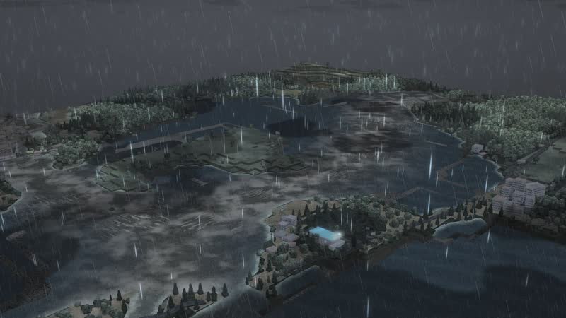
Heavy rain – it grows dark, dense rain sweeps over the land, the soils soak up all they can. -
Thunderstorm – lightning in view, the cloud lights up from within around the strike, the cover tears open along the line of sight. -
Flood by contour lines – the floodplain and low-lying districts fill up bit by bit, with a dirty rim of foam. -
Pipe burst – the line pulses red, water escapes; a crew is called out. -
Shut off – a crew drives out, the section stands still, the storage carries the town until the repair is done. -
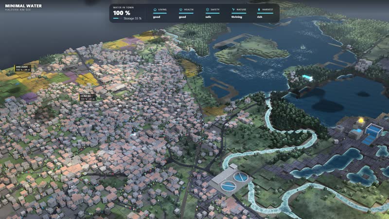
The districts by name – above the map stand the quarters, at the top water in the city, storage and the five consequences. -
Town centre and the neighbouring districts – each name shows with a bar how well the district is supplied. -
Signs on the map – when a consequence turns critical, its sign stands where it happens: fields wither, forest dies, no water. -
Flood in figures – safety and harvest fall, the sign by the river stands over the spot that fills first. -
Treatment plant and inflow – on the sewer it says how much is arriving and whether it overflows. -
The whole software – at the top water in the city and five consequences, on the right the wheel of the cycle, below four weather situations and three levers. -
Hot summer with one tap – the levers visibly move there, the camera follows the effect, below a sentence explains what is happening. -
One lever, visible at once – consumption set to wasteful: the town needs more, the storage sinks, an arrow at the top shows the direction. -
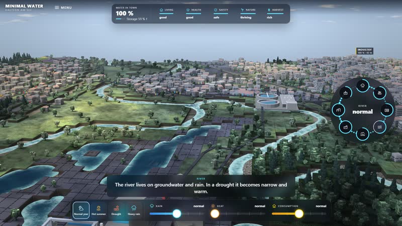
The wheel explains – station River tapped: The river lives on groundwater and rain. In a drought it becomes narrow and warm. -
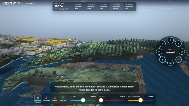
Tap a consequence – Nature: the bar at the top explains what water means for people and nature. -
Drought in the interface – the consequences turn red, signs stand on the map, the subtitle says what comes next. -
Heavy rain in the interface – soil and river on the wheel rise, the flood sign stands by the river, safety falls. -
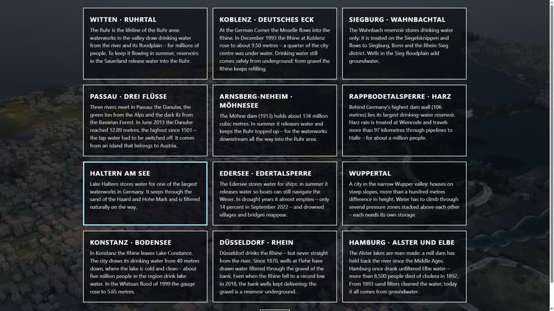
Twelve water landscapes – confluences, dams and large lakes across Germany, each in its real place. -
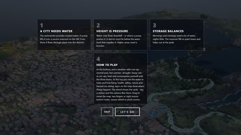
The introduction – four cards say what it is about and how to use it.
Your area as a model
Would you like to show your area, your museum or your school like this? Write to us or call. We will send you the password for starting it on request.
cube4tec.de/spiele/minimal-water/
Ask about this
Minimal Water: Haltern am See – Stausee und Wasserwerk
Basis and limits
Terrain and buildings: © OpenStreetMap contributors (ODbL), elevation: Mapzen/Tilezen Terrain Tiles (SRTM, EU-DEM). Waterworks location follows OpenStreetMap; tower, pipe network, sizes and demand are invented and simplified. Simplified educational model – not a real control system and not a planning tool.
Public sources the model is based on:
- Terrain and buildings: © OpenStreetMap contributors (ODbL)
- Elevation: Mapzen/Tilezen Terrain Tiles (SRTM, EU-DEM)
More areas in the model
-
Siegburg · Wahnbach valley – a reservoir for drinking water only
A drinking-water dam as a model: intake below the dam wall, treatment on the Siegelsknippen, almost five kilometres of downpipe into the valley and groundwater from the Sieg floodplain, mixing in the service reservoir.
-
Arnsberg-Neheim · Möhne lake – the dam keeps the Ruhr topped up
A large dam as a model: the long Möhne lake, the water abstraction in the Möhne bend and two service reservoirs one above the other that supply the lower and upper zones of Neheim with pressure.
-
Witten · Ruhr valley – water from the river and its floodplain
A Ruhr valley as a model: waterworks, pumping station, Helenenberg service reservoir and Bommerholz water tower, plus floodplain, forest and sewage plant, and three controls that move the whole landscape.
Real are location, terrain and buildings (OpenStreetMap, heights from SRTM and EU-DEM). The water tower, the pipe network, sizes and demand are invented and simplified, and treatment is a feed-in with limited capacity. It is not an operations control and not a planning tool. With your data, the mod…